ShoreZone Resources
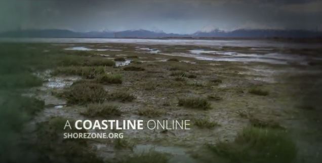
A Coastline Online: ShoreZone.org
Documentary by 360 North
Coastal and Arctic Impressions
A Photographic Journey along Alaska’s Coasts


2016 Annual ShoreZone Partner Meeting
Presentations delivered at the 2016 ShoreZone Partner meeting on October 12-13 in Anchorage, Alaska
- Welcome and Introduction (Susan Saupe, CIRCAC)
- ShoreZone Partnerships, Coordination and Outreach (Mandy Lindeberg, NOAA, NMFS)
- ShoreZone Progress Report (Carl Schoch, Coastal and Ocean Resources, Inc.)
- Image Acquisition in 2016 (Kalen Morrow, CORI)
- Revised ShoreZone Protocols Part 1 (Sarah Cooke, CORI)
- Revised ShoreZone Protocols Part 2 (Carl Schoch, CORI)
- NOAA Website and Data Interface (Steve Lewis, NOAA, NMFS)
- Planning for Future ShoreZone Work (Cindy Hartmann Moore, NOAA, NMFS)
- ERMA and Updates fron NOAA ORR (Zach WInters, ERMA)
- CIRCAC 2016 ShoreStation Surveys and ShoreZone Integration (Sue Saupe, CIRCAC)
- Filling that Pesky SE Alaska ShoreZone “Gap” (Lewis Sharman, NPS, Glacier Bay National Park and Preserve)
- Marine Debris Along the Northern Gulf of Alaska Coast (Chris Pallister, Gulf of Alaska Keeper)
- NOAA 2016 Semi-Oblique Coastal Imaging and CUSP Digital Shoreline (Nicole Kinsman, NOAA, NGS)
- The CoastView Travel App: Providing a Virtual Experience for Coastal Adventure (Amalie Couvillion, CoastView)
2015 Annual ShoreZone Partner Meeting
Presentations delivered at the 2015 ShoreZone Partner meeting on October 13-14 in Anchorage, Alaska
- Welcome and Introduction (Susan Saupe, CIRCAC)
- ShoreZone Partnerships, coordination and outreach (Mandy Lindeberg, NOAA)
- ShoreZone progress report: ShoreZone updates and a look ahead (Carl Schoch, CORI)
- Norton Sound imaging summary (Kalen Morrow, CORI)
- New ShoreZone modules and mapping protocols (Kalen Morrow, CORI)
- New bioband mapping protocols (Sarah Cook, CORI)
- Alaska Peninsula and YK Delta mapping summary (Sarah Cook, CORI)
- Planning for and funding future ShoreZone work (Cindy Hartmann Moore, NMFS)
- ShoreZone offline viewer (Andy Lanier, Oregon Coastal Management Program)
- Structure from motion (Nicole Kinsman, NOAA)
- Mapping blue carbon (Sarah Cook, CORI)
- Integration of ShoreZone into the AOOS Alaska portal (Stacey Buckelew, Axiom)
- Geomorphology and sustainable traditional gathering patterns (Adelaide Johnson, USFS)
- Coastal and Marine Ecological Classification Standard, CMECS (Mark Finkbeiner, NOAA)
- Lower Cook Inlet nearshore habitat assessment, an NPS-led study (Tahzay Jones, NPS)
- The utility of Lidar for ShoreZone mapping (Carl Schoch, CORI)
- ShoreZone Data Management (Steve Lewis and Jim Noel, NOAA)
2014 Annual ShoreZone Partner Meeting
Presentations delivered at the 2014 Annual ShoreZone Partner meeting
- Introduction to ShoreZone (Mandy Lindeberg, NOAA)
- ShoreZone highlights from 2014 (Carl Schoch, Coastal and Ocean Resources)
- Marine Use Planning for Haida Gwaii, British Columbia (Chris McDougall, Haida Ocean Technical Team)
- ShoreZone to the Rescue: Applications and Use in Oil Spill Planning and Response (Sue Saupe, CIRCAC)
- Using ShoreZone To Locate Intertidal Archaeological Sites, part 1 & part 2 (Martin V. Stanford, US Forest Service)
- Using ShoreZone to Refine Estimates of Oil Retention on Shorelines: a Cross‐Border Example (John Harper, Coastal and Ocean Resources)
- Applications of ShoreZone in Conservation Planning and Implications for Climate Resilience (Zach Ferdaña, The Nature Conservancy)
- North Slope Sense of Place (Phase II) Project (Marie Acemah, Media Action)
- Applications of ShoreZone in Washington State (Helen Berry, Washington DNR)
- Data management subcommittee report out (Carl Schoch, Coastal and Ocean Resources)
- Education and outreach subcommittee report out (Sue Saupe, CIRCAC)